 Eucentre is a non-profit private law foundation whose mission is to conduct research and provide training and services in earthquake and safety engineering
  Eucentre promotes science, research and innovation for the benefit of the community, offering targeted methodologies and concrete solutions for prevention, safety and resilience. It collaborates with institutions and companies to disseminate competencies for the common good.
 Eucentre conducts earthquake engineering research and risk reduction studies via laboratory testing and numerical analysis to enhance seismic performance and develop innovative solutions
  Eucentre carries out research activities in earthquake engineering and risk reduction through laboratory testing and numerical analysis, aiming to improve the seismic performance of structures and soils and to develop innovative seismic retrofitting techniques.
 The Foundation promotes diverse and high-quality training activities aimed at academic and professional contexts, with constantly updated and innovative programs and initiatives designed to meet the evolving needs of the sector and society
  Eucentre ensures communication aimed at informing institutions, professionals, and citizens about ongoing activities and projects, with the goal of disseminating useful and accessible content and knowledge. It contributes to promoting a shared and informed culture of prevention and resilience.
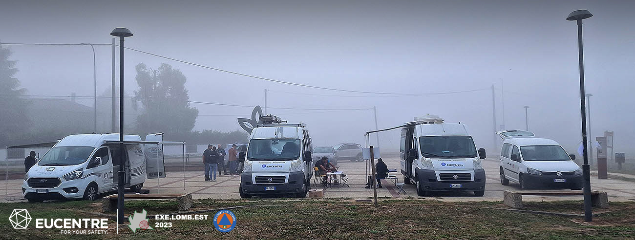
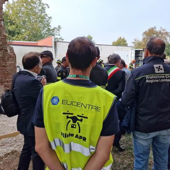
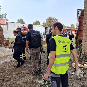
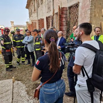
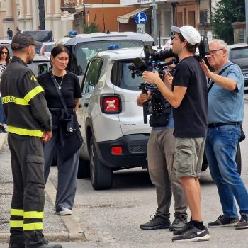
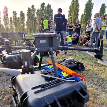
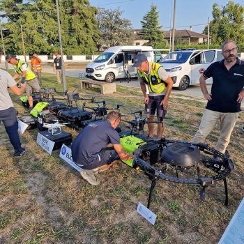
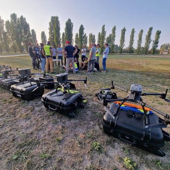
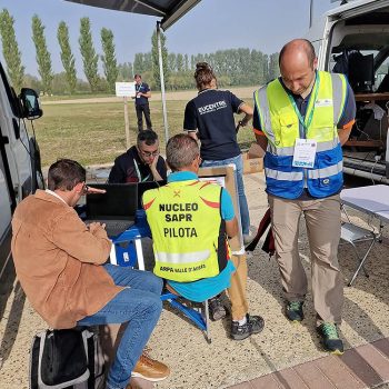
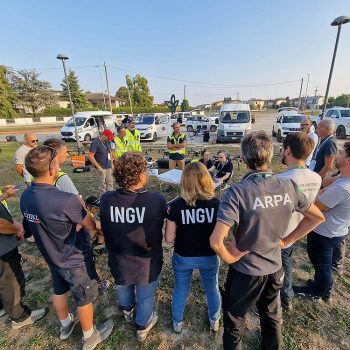
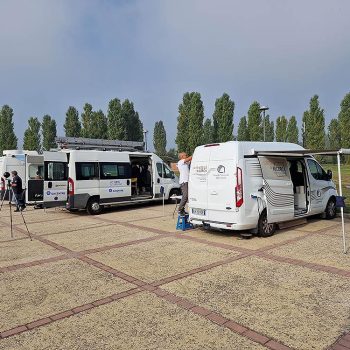
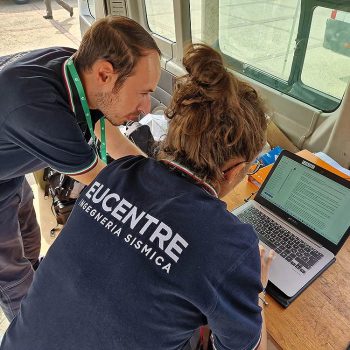
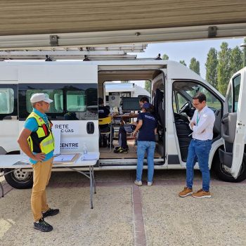
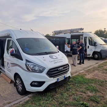
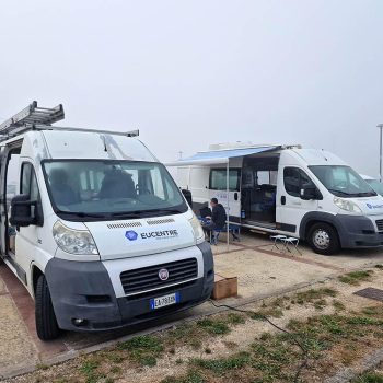
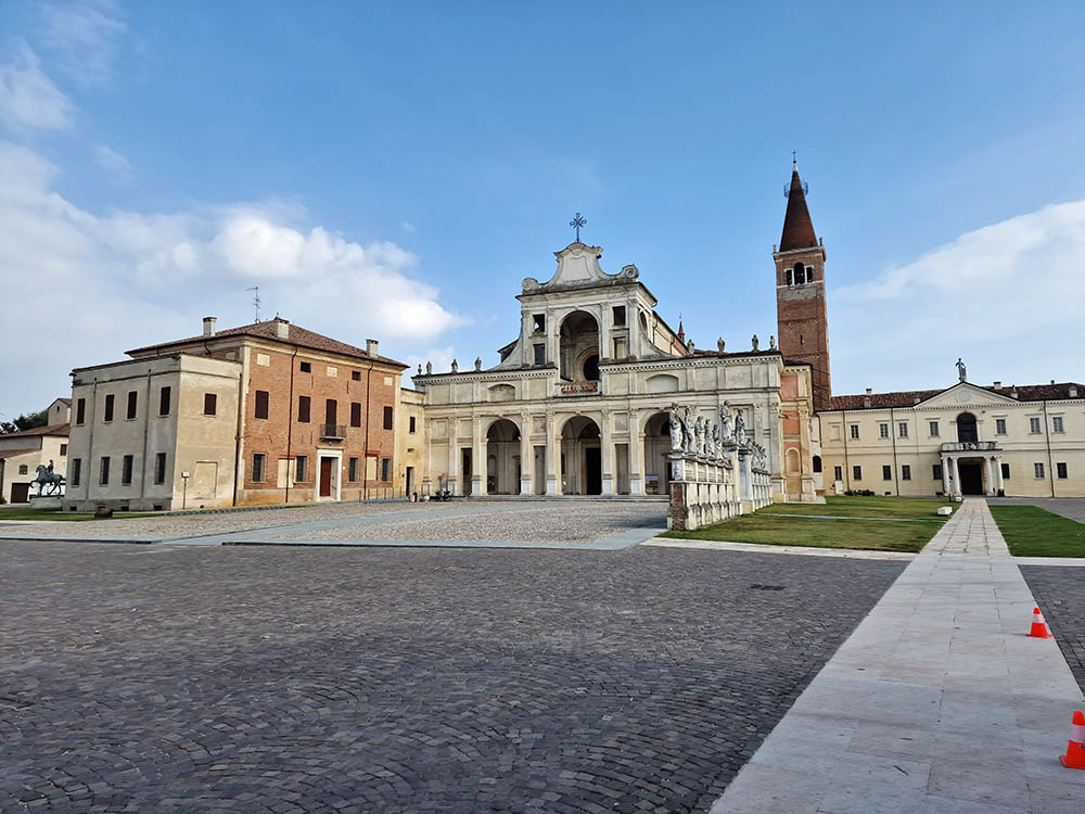
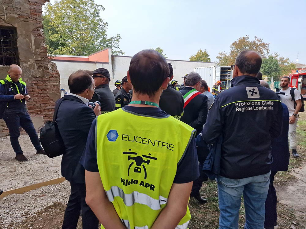
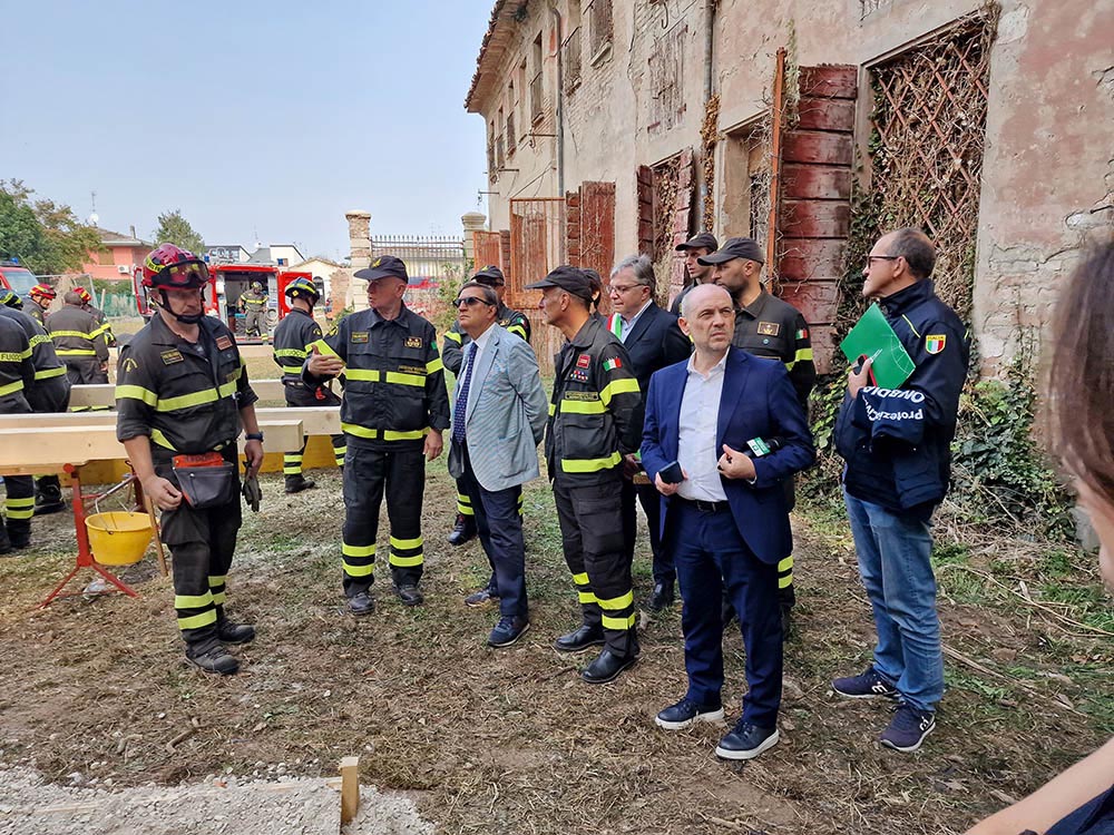
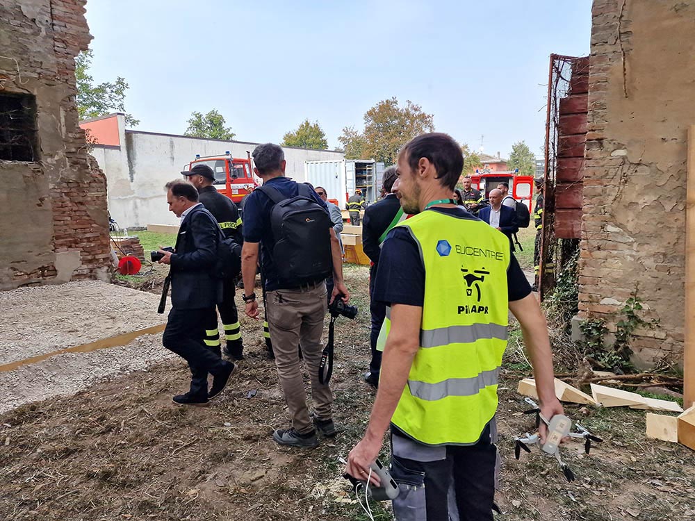
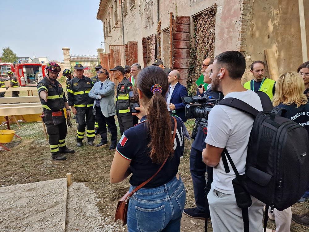
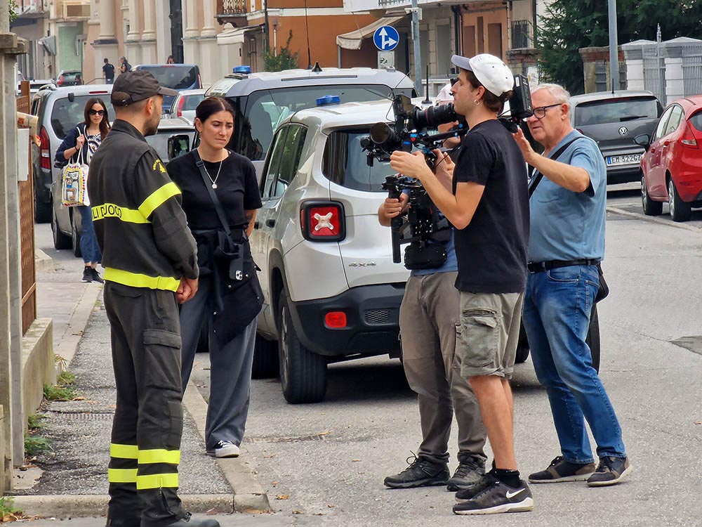
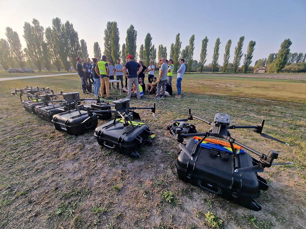
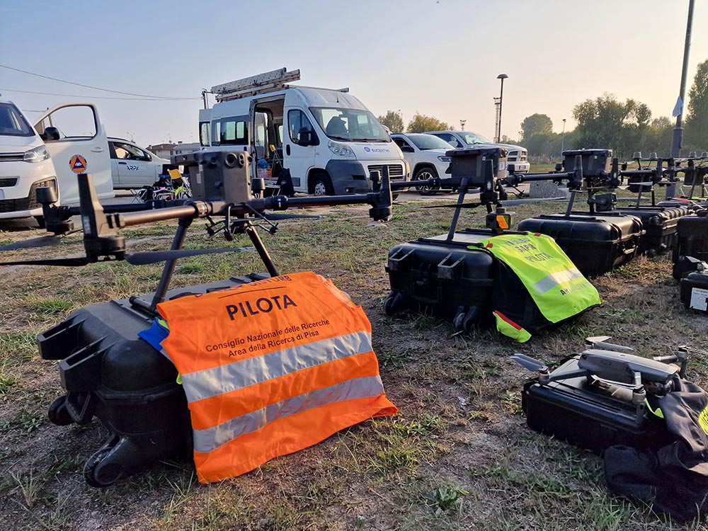
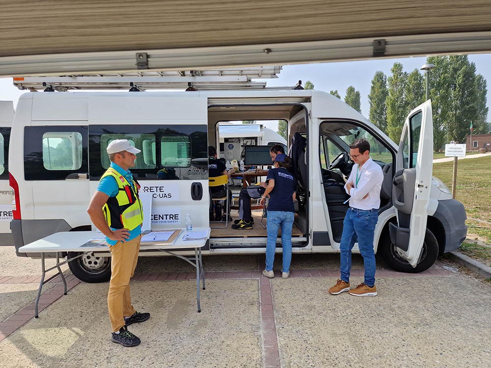
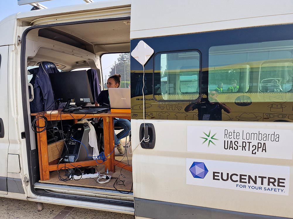
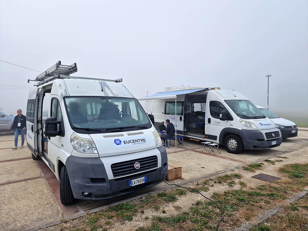
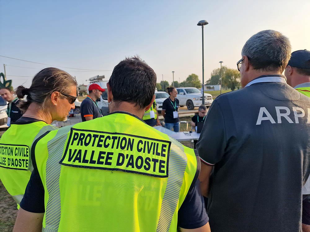
Data collection, coordination, and communication, as well as interaction with other operators and managers, and the use of aerial space, are all crucial in emergency contexts, such as floods or earthquakes are the main objectives of the technical exercise focused on the use of drones for civil protection activities, taking place between Oct. 9 and Oct. 14, in conjunction with and on the occasion of the fifth edition of Italian Civil Protection Week. The exercise has been organised by the Civil Protection Organisational Unit of the Lombardy Region, in collaboration with Polis Lombardia and Anci Lombardia, and coordinated by EUCENTRE Foundation, the seismic risk competence centre of the Italian Civil Protection Department.
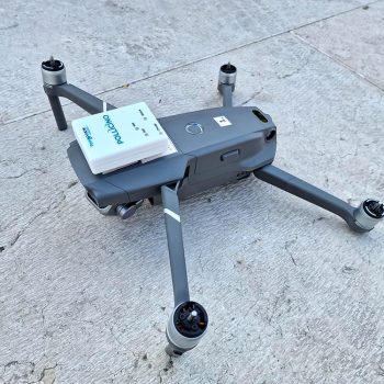
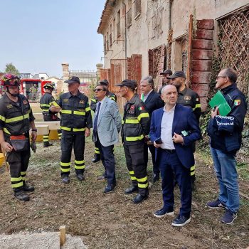
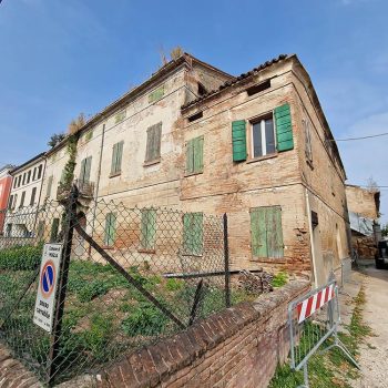
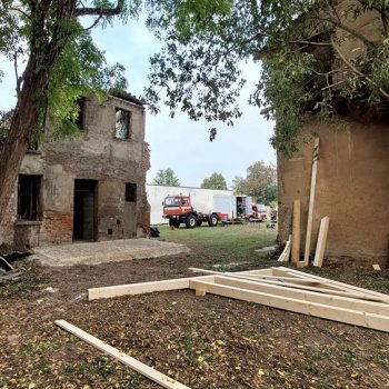
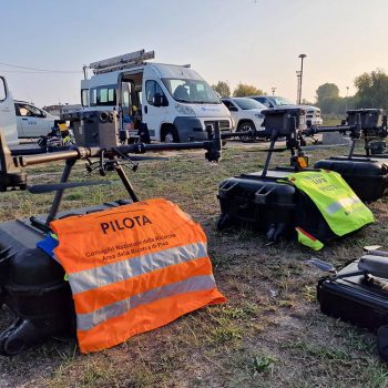
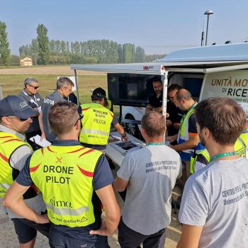
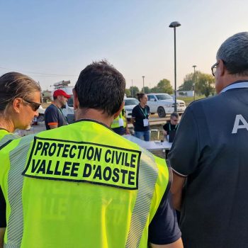
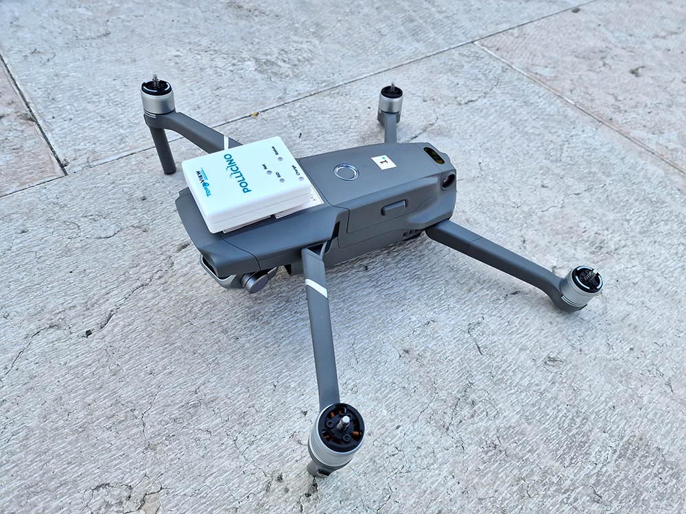
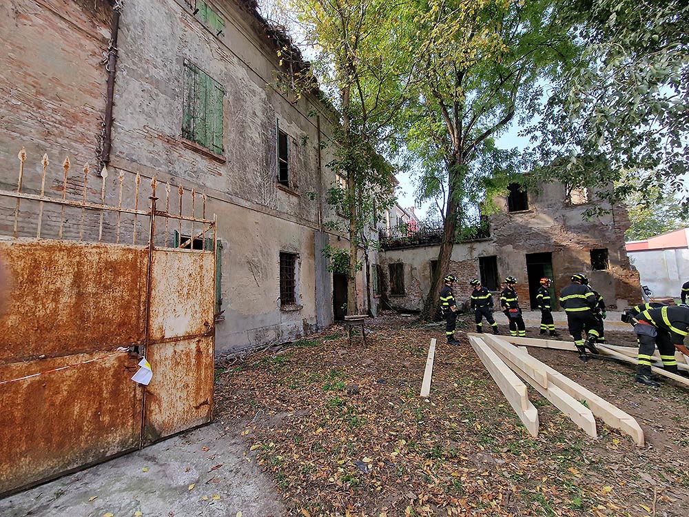
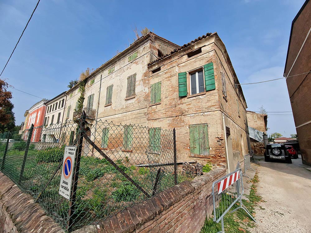
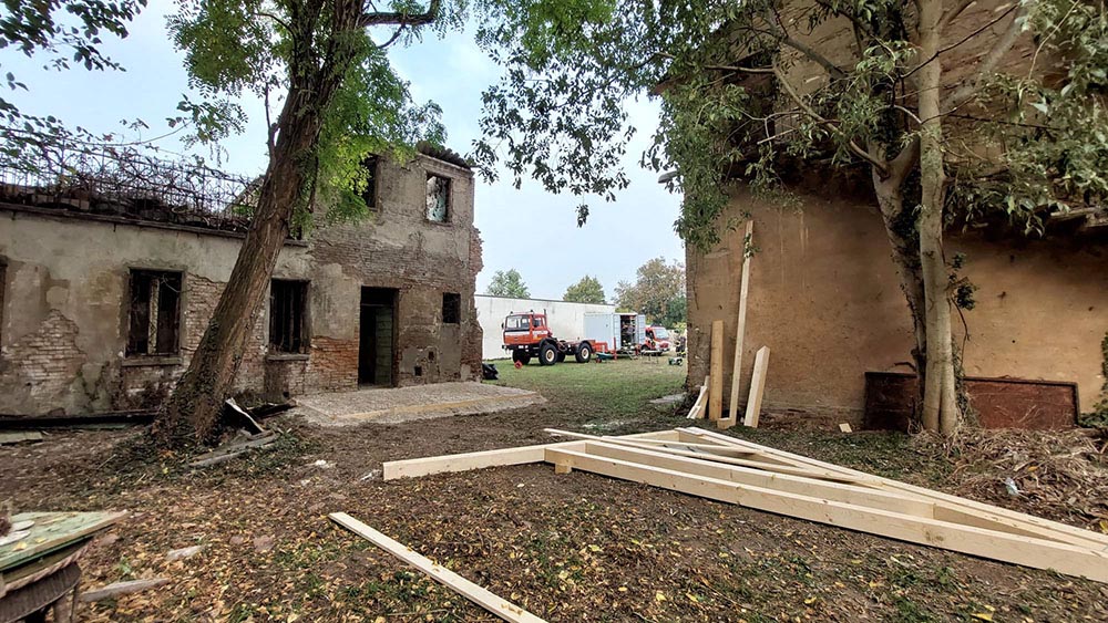
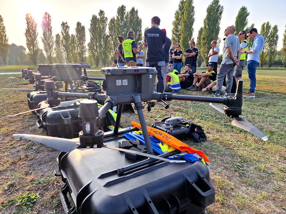
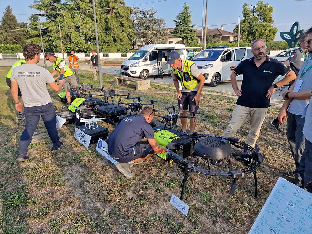
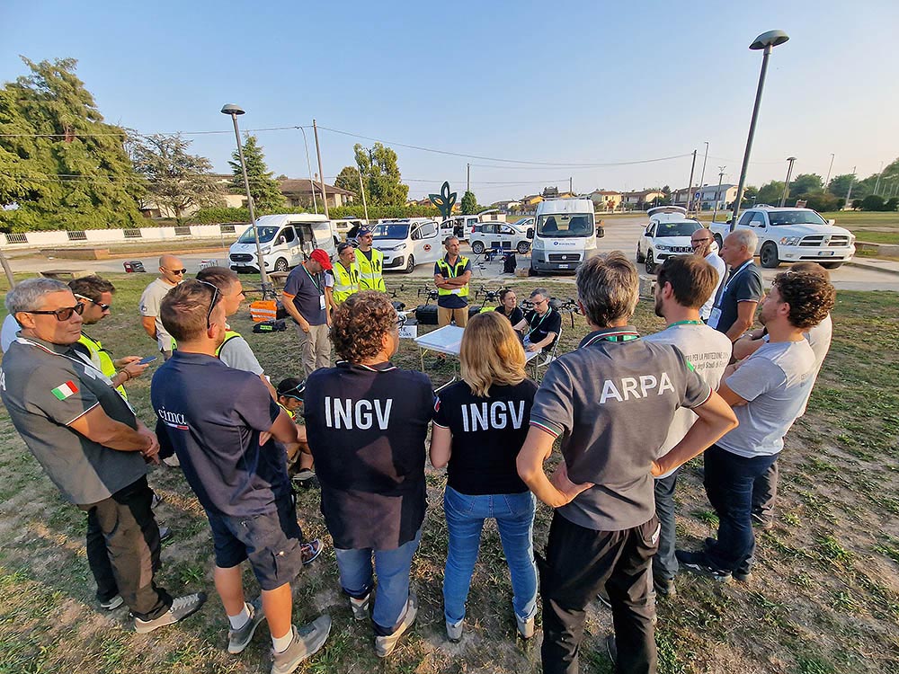
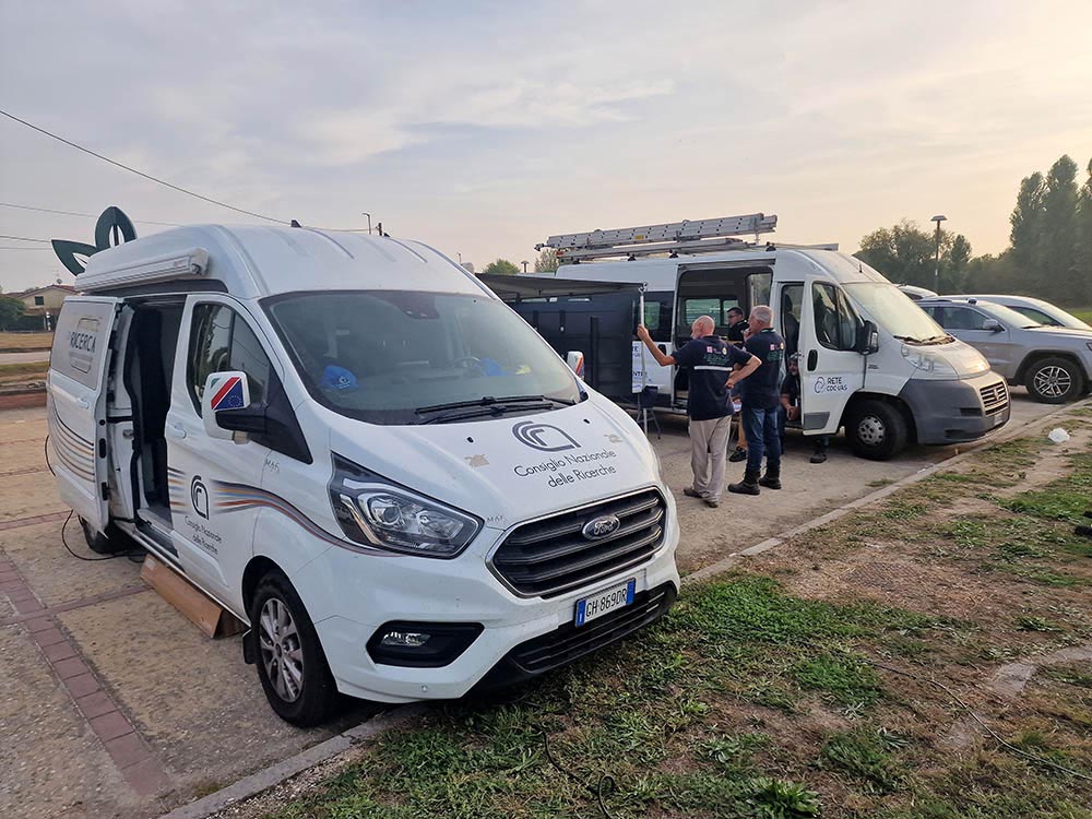
An earthquake affecting the province of Mantua is the imaginary scenario in which the exercise takes place. In a vast emergency scenario, whose potential damage has a significant impact on the territory, to have a quick and updated picture of the situation, including damages, extension of impacted areas, and limitations for the rescue operations, is critical. This is known as rapid assessment – a first, quick assessment of the situation in an emergency context, conducted by the Italian Civil Protection Department’s centres of expertise. Among the resources that can be fielded for this purpose are the teams of the drone nuclei of different centres of competence (UAS or Uncrewed Aircraft Systems): EUCENTRE Foundation, INGV, CNR, ARPACAL, ARPA Lombardia, ARPA VDA, UNIFI Civil Protection Centre and CIMA Research Foundation.
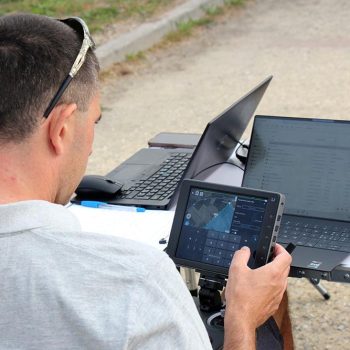
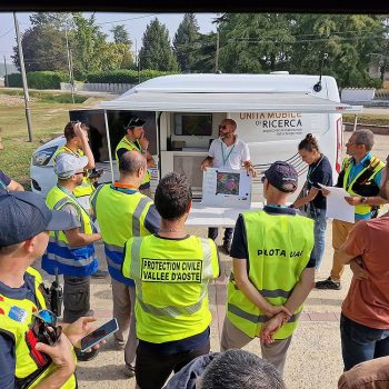
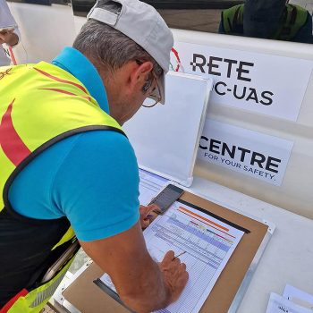
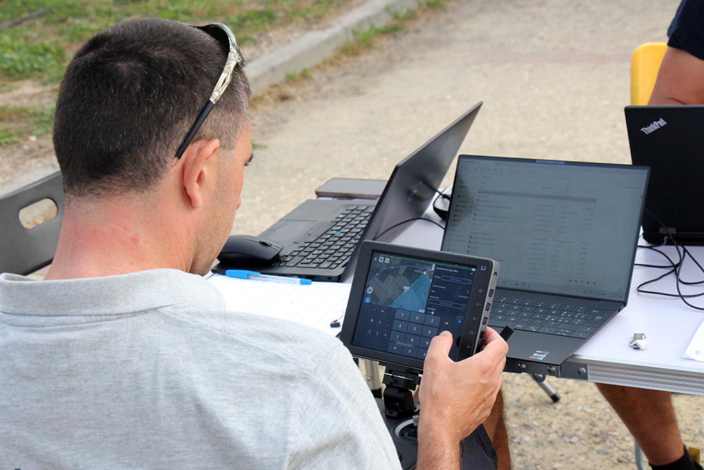
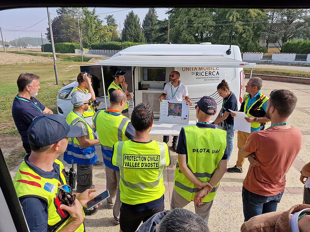
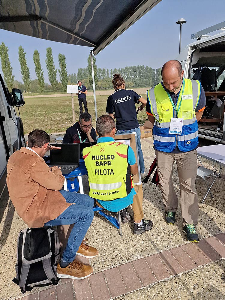
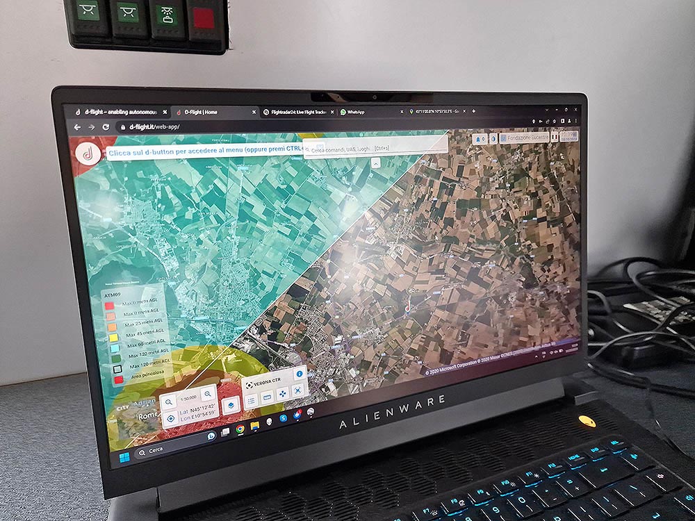
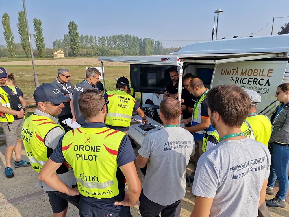
A major aspect is the protocols for activating UAS units, particularly regarding the management and sharing of airspace (for example, in the event of a rescue helicopter’s arrival). For the first time, coordination protocols for air operations and activation, agreed upon for the occasion with CNVF, ENAC, and ENAV/D-flight, are being tested.
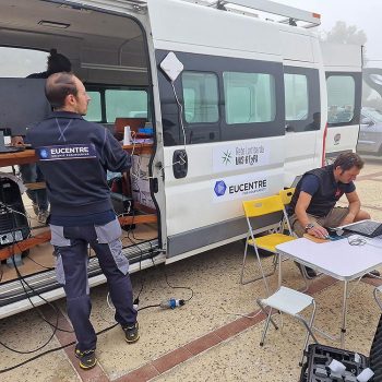
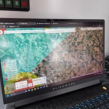
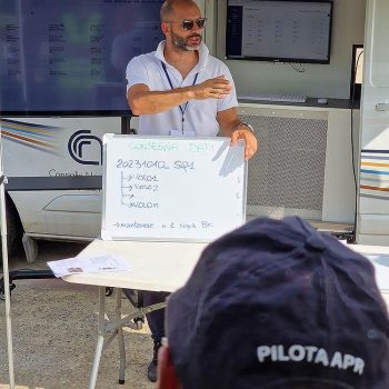
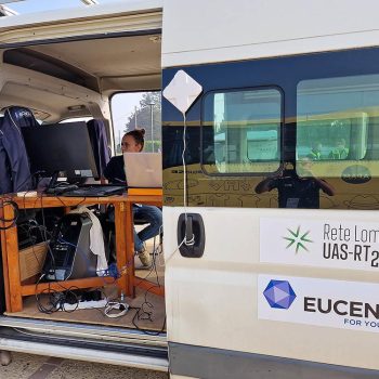
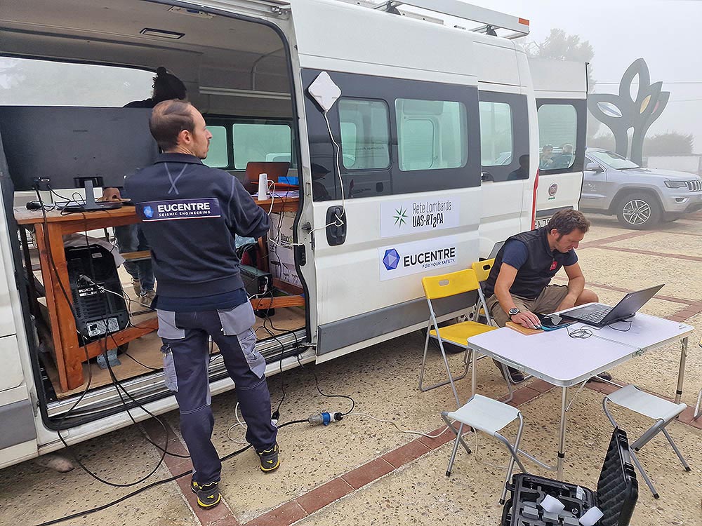
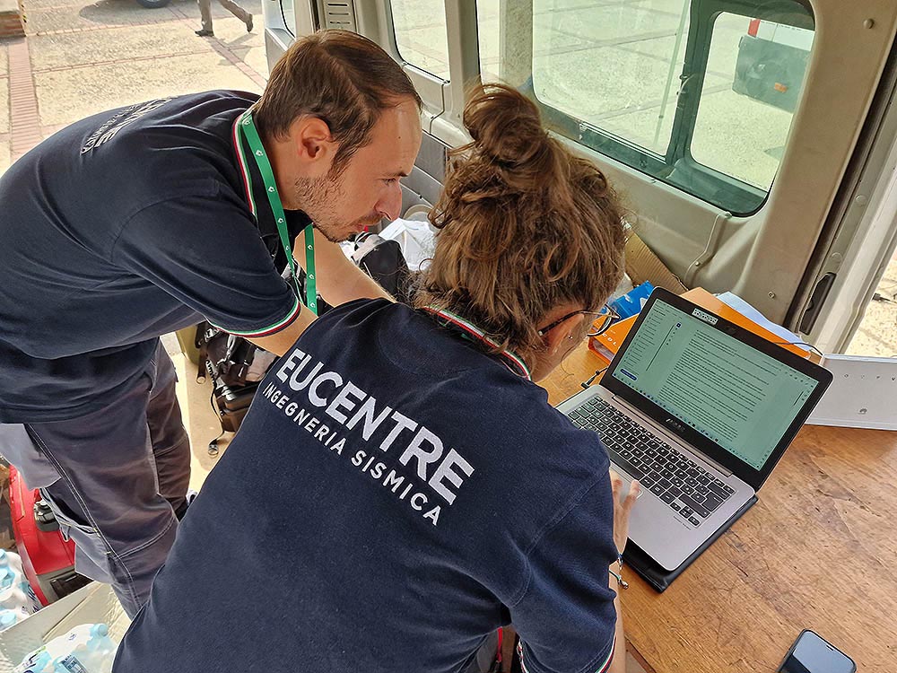
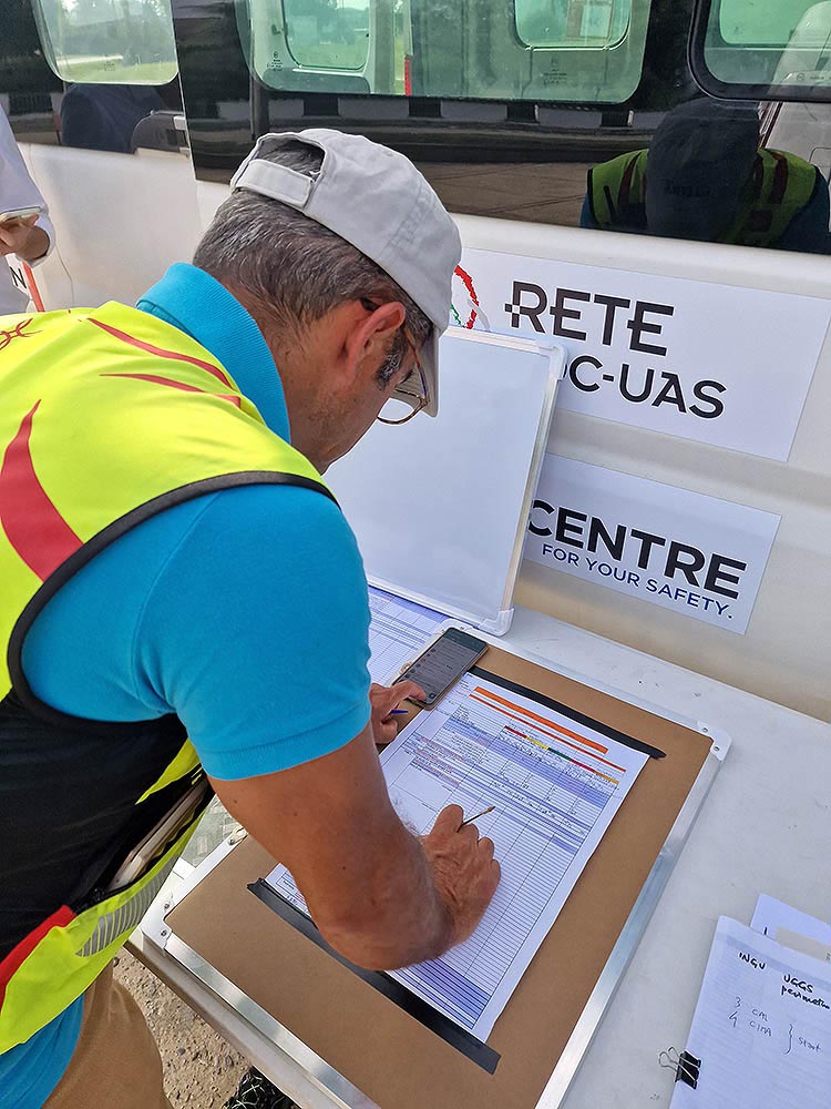
Another part of the exercise is focused on technical aspects. First, regarding data collection: the surveys are carried out by the various teams, each of which proceeds to map a specific area adjacent to the others, and they must be comparable with each other. Therefore, standard protocols must be well established. A second aspect addressed concerns activation of UAS nuclei, safety and coordination protocols, not only for the synchronous flight of the drone teams but, more generally, for the management of the flight space (think, for example, of the eventuality of the arrival of a rescue helicopter). Finally, the exercise involves the rapid processing of the data collected, which must be made available to the coordination centre in time to organise the operations.
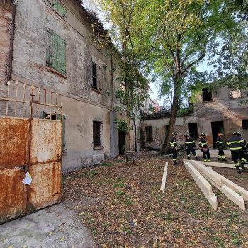
These initial activities will be followed by more specific ones dedicated to some technical and detailed aspects of drone assessments in an emergency context. For example, a survey on specific elements, such as a road or a cultural asset, for instance a church, or the estimation of the amount of debris to be mobilized to have a communication route. It is, in this case, not a quick assessment, providing a global look at the situation, but an analysis that requires different technical arrangements and specific and more complex operational protocols.
Beyond the expertise on different types of hazards offered by various centres of expertise, drone surveying capabilities share some common elements, particularly in their ability to reconstruct the state of places affected by a catastrophic event. This is why centres of expertise whose activities do not specifically concern seismic risk are also involved in the exercise.
