Eucentre is a non-profit private law foundation whose mission is to conduct research and provide training and services in earthquake and safety engineering
  Eucentre promotes science, research and innovation for the benefit of the community, offering targeted methodologies and concrete solutions for prevention, safety and resilience. It collaborates with institutions and companies to disseminate competencies for the common good.
 Eucentre conducts earthquake engineering research and risk reduction studies via laboratory testing and numerical analysis to enhance seismic performance and develop innovative solutions
  Eucentre carries out research activities in earthquake engineering and risk reduction through laboratory testing and numerical analysis, aiming to improve the seismic performance of structures and soils and to develop innovative seismic retrofitting techniques.
 The Foundation promotes diverse and high-quality training activities aimed at academic and professional contexts, with constantly updated and innovative programs and initiatives designed to meet the evolving needs of the sector and society
  Eucentre ensures communication aimed at informing institutions, professionals, and citizens about ongoing activities and projects, with the goal of disseminating useful and accessible content and knowledge. It contributes to promoting a shared and informed culture of prevention and resilience.
The Eucentre Foundation offers an integrated system of services in the field of Advanced Surveying & Digital Modelling, dedicated to surveying, digitisation, inspection, and structural monitoring of buildings and infrastructure. Through the combined use of high-resolution drones, laser scanning, BIM modelling techniques, visual and instrumental inspection, satellite monitoring, and artificial intelligence techniques for the automatic detection of damage, Eucentre is able to produce accurate and interoperable digital models, useful for structural assessments, life-cycle management of works, and – more generally – to support the digital transition of the construction sector.
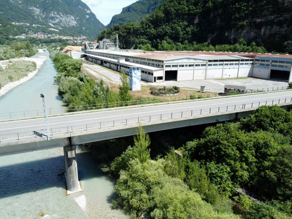
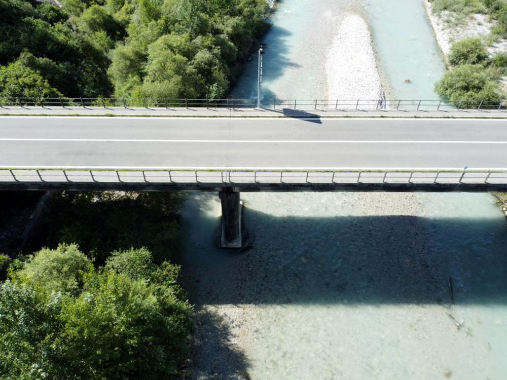
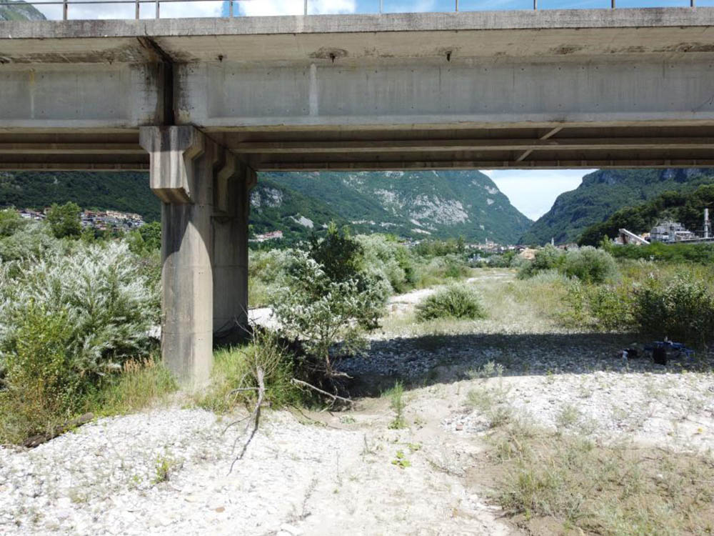
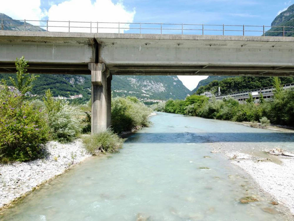
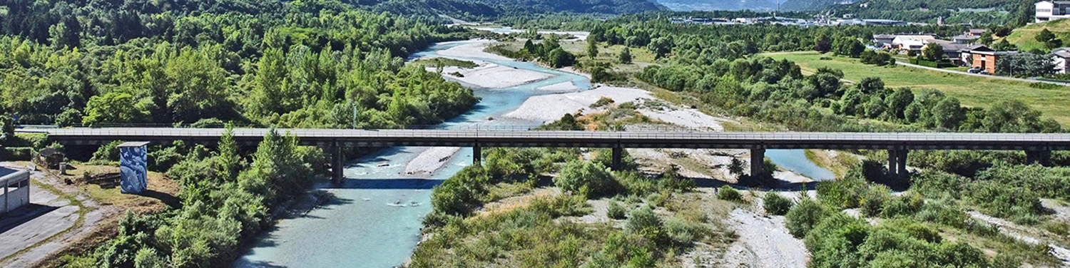
A recent assignment commissioned by Studio Calvi Beam Srl made it possible to apply this methodology to a concrete case: the three-dimensional survey of a bridge over the Piave river, in the municipality of Longarone (BL), in the province of Belluno.
The survey: method, technology, operational protocol
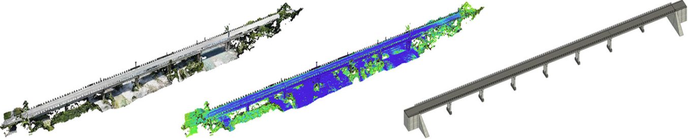
The objective of the intervention was the complete geometric reconstruction of the artefact by means of drone photogrammetric techniques, with the ambition of producing a model of the bridge.
The flight campaign involved a combination of manual and automatic trajectories to ensure coverage of all significant structural elements: piers, abutments and side elevations.
Data processing and final product
The images acquired by drone survey were processed using computational photogrammetry techniques, allowing the generation of a high-density three-dimensional point cloud. The point cloud thus obtained was subsequently imported into the BIM environment, where the information model of the work was developed.
The resulting BIM model constitutes a reliable geometric and information basis for the subsequent definition of structural models aimed at assessing the seismic vulnerability of the infrastructure, as well as for possible structural analysis and life-cycle management activities of the structure.