Eucentre is a non-profit private law foundation whose mission is to conduct research and provide training and services in earthquake and safety engineering
  Eucentre promotes science, research and innovation for the benefit of the community, offering targeted methodologies and concrete solutions for prevention, safety and resilience. It collaborates with institutions and companies to disseminate competencies for the common good.
 Eucentre conducts earthquake engineering research and risk reduction studies via laboratory testing and numerical analysis to enhance seismic performance and develop innovative solutions
  Eucentre carries out research activities in earthquake engineering and risk reduction through laboratory testing and numerical analysis, aiming to improve the seismic performance of structures and soils and to develop innovative seismic retrofitting techniques.
 The Foundation promotes diverse and high-quality training activities aimed at academic and professional contexts, with constantly updated and innovative programs and initiatives designed to meet the evolving needs of the sector and society
  Eucentre ensures communication aimed at informing institutions, professionals, and citizens about ongoing activities and projects, with the goal of disseminating useful and accessible content and knowledge. It contributes to promoting a shared and informed culture of prevention and resilience.
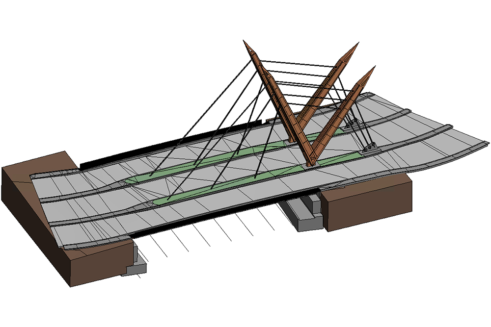
The Eucentre Foundation offers advanced services for the surveying, digitisation and BIM (Building Information Modelling) modelling of bridges and infrastructure, to support structural assessment, scheduled maintenance and digital lifecycle management of structures. Depending on the requirements and conditions surrounding the survey – such as the presence of waterways, difficulty in accessing the areas to be surveyed or limited possibilities for positioning equipment on the ground – the survey can be carried out using terrestrial laser scanners or photogrammetric surveys from drones (UAS), or through an integrated combination of the two techniques. The combined use of UAS, laser scanners, diagnostic sensors, and photogrammetric techniques enables high-resolution three-dimensional surveys and digital information models (Digital Twins) that integrate geometric, material, and structural data. The activities include all phases of the acquisition and modelling process:
- Preliminary analysis and operational planning, with verification of aeronautical, environmental and regulatory conditions;
- Aerial and terrestrial surveying, in compliance with ENAC/EASA requirements and safety measures in the field;
- Aerial photogrammetric processing and laser scanning of the collected data, with the generation of dense, georeferenced point clouds;
- Digital BIM restitution for documentation, inspection and assessment of the state of conservation of the structures.
The ultimate goal is to provide an accurate, interoperable three-dimensional model that enables the integration of geometric, structural, and environmental information over time, facilitating predictive management and scheduled maintenance of engineering structures.
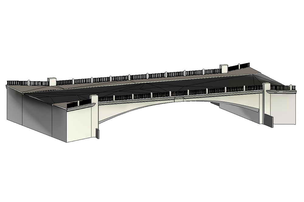
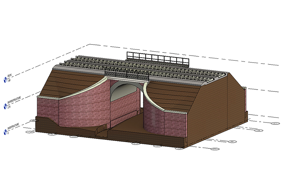
Case study: 3D survey and rendering of a bridge in the province of Belluno
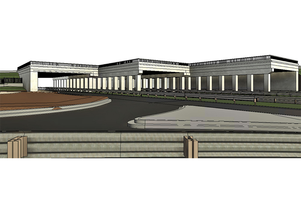
As part of a contract for Studio Calvi Beam Srl, Eucentre conducted a three-dimensional survey of a bridge over the Piave River in the municipality of Longarone (BL). The project aimed to reconstruct the structure in 3D using photogrammetric techniques, employing drones in standard IT-STS-01 and IT-STS-02 operating scenarios, in accordance with current aeronautical regulations. Before the flight operations, the Eucentre team carried out the necessary aeronautical and environmental checks, verifying the absence of flight restrictions via the D-Flight portal, weather conditions and GNSS signal stability. All operations were carried out in VLOS (Visual Line of Sight) and in compliance with safety distances, ensuring the protection of privacy and the safety of people and infrastructure. The survey involved a series of manual and automated flights, with lateral and circular trajectories, to acquire high-resolution images of the piers, abutments, and side elevations of the bridge. Where it was not possible to interrupt traffic, flights over the deck were conducted at a safe distance.
In contrast, flights over the piers and lower parts were conducted at lower altitudes to obtain more detailed information. The collected images were processed to generate three-dimensional point clouds in .las and .e57 formats. Quality, filtering, and metric verification analyses were conducted, integrating the information into an accurate, valuable digital model for future structural analyses and for integration into a BIM environment. The final result is a high-fidelity three-dimensional reconstruction of the entire infrastructure and individual structural elements.