Eucentre is a non-profit private law foundation whose mission is to conduct research and provide training and services in earthquake and safety engineering
  Eucentre promotes science, research and innovation for the benefit of the community, offering targeted methodologies and concrete solutions for prevention, safety and resilience. It collaborates with institutions and companies to disseminate competencies for the common good.
 Eucentre conducts earthquake engineering research and risk reduction studies via laboratory testing and numerical analysis to enhance seismic performance and develop innovative solutions
  Eucentre carries out research activities in earthquake engineering and risk reduction through laboratory testing and numerical analysis, aiming to improve the seismic performance of structures and soils and to develop innovative seismic retrofitting techniques.
 The Foundation promotes diverse and high-quality training activities aimed at academic and professional contexts, with constantly updated and innovative programs and initiatives designed to meet the evolving needs of the sector and society
  Eucentre ensures communication aimed at informing institutions, professionals, and citizens about ongoing activities and projects, with the goal of disseminating useful and accessible content and knowledge. It contributes to promoting a shared and informed culture of prevention and resilience.

Let us imagine heavy, persistent rainfall across much of the Po River basin. Water levels rise gradually along all the tributaries and the main river. Landslides, mudslides, disruptions to road networks, and widespread problems affect various areas across Piedmont, Lombardy, Emilia-Romagna, and Veneto. This is the scenario for EXE Po 2026, the national flood risk exercise taking place from 25 to 27 June and coordinated by the Italian Department of Civil Protection.
For three days, the civil protection system is putting its procedures, tools, and coordination capabilities to the test in one of Italy’s most complex contexts. The exercise involves institutions, operational units, local authorities, the research community, and centres of expertise, each of which is called upon to test, in the field, its ability to respond to an event affecting the entire Po river basin.
Among the organisations involved – a total of 11 centres of expertise – is the UAS network of the Department of Civil Protection’s centres of expertise, comprising Arpa Valle d’Aosta, the Centre for Civil Protection at the University of Florence, the National Research Council, the CIMA Foundation and the Eucentre Foundation, which are engaged in observation, surveying and technical-scientific support activities through the use of remotely piloted systems and Earth observation technologies.
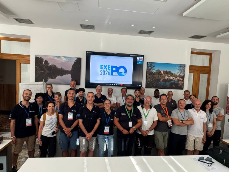
The civil protection system’s UAS network tackles a scenario involving flooding of the River Po
During the exercise, each team within the UAS network operates in a coordinated manner, pooling complementary expertise and tools to gather information about the terrain and support the development of a shared understanding of the scenario.
“Exercises such as EXE Po 2026 are opportunities for us to put things to the test: not only our tools and procedures, but also our ability to operate effectively within a complex system, in coordination with other centres of expertise and with operational units on the ground. Deploying Eucentre’s drone unit to a flood scenario on this scale allows us to gauge how much our expertise can genuinely contribute beyond the context for which it was originally developed”, comment Chiara Casarotti and Martina Mandirola, from the Eucentre Foundation’s UAS unit.
The activities are primarily based on drone surveys (optical, thermal, Lidar, and multispectral) to acquire and analyse geospatial data needed to understand and manage the event, support operations centres, and test procedures aimed at improving our understanding of the simulated impacts and critical issues. Operational staff are deployed directly in the areas affected by the exercise, whilst specialist personnel support coordination of activities at the headquarters of the Interregional Agency for the River Po (AIPo) in Parma.
“Rapid assessment using drones is one of the capabilities that Eucentre has developed in the field of seismic risk and which is also proving useful in flood emergency situations. In a scenario such as that simulated by EXE Po 2026 – vast, dynamic, with critical issues spread across several regions – the ability to rapidly acquire geospatial data and make it available to operations centres is a concrete contribution to the management of the event”, add Casarotti and Mandirola.
Alongside the use of remotely piloted systems, the exercise also provides an opportunity to test the integration of different information sources. In particular, the procedures for activating and utilising the satellite products requested by the regions involved are being tested, assessing the availability and operational usefulness of the data in the areas of interest and experimenting with their integration into information flows to support scenario monitoring and analysis activities.
“In a vast area such as that of the River Po, no single technology is sufficient on its own to capture the complexity of the event. The exercise offers us the opportunity to verify how observations collected just a few metres above the ground and data acquired from space can interact, helping to build a more comprehensive and dynamic picture of the situation. Linking the data collected by drones, satellite information and operational requests from the field means putting into practice that process of knowledge integration which, during a real emergency, can help transform data into situational awareness and decision support”, commented Umberto Morra di Cella, UAV manager, and Luca Pulvirenti, satellite observation manager, at the CIMA Foundation.
Technology and collaboration to strengthen emergency response capabilities
EXE Po 2026 represents an important opportunity to test in the field how scientific expertise, technological innovation and operational capabilities can be integrated to support civil protection activities.
For the network of Centres of Excellence, the exercise provides an opportunity to test not only the tools and procedures, but also the collaboration between organisations with different yet complementary areas of expertise. This joint effort helps to strengthen the National Civil Protection Service’s ability to acquire timely information, improve understanding of scenarios and support decision-making processes in emergency situations.
“One of the most valuable aspects of the exercise was the opportunity to work in close collaboration with the COAU, the central body responsible for the operational coordination of the aviation sector during emergencies of national significance. The chance to test procedures, decision-making flows and methods of integration in a practical context provided an important opportunity for discussion and mutual development, both during the exercise planning phase and in the subsequent assessment and operational verification phase.
The experience gained will form a solid foundation for further developments and refinements, with the aim of making the Centres of Excellence’s use of drones in support of the National Department for Emergency Management increasingly effective and structured. At the same time, it will help to consolidate operational models capable of ensuring that operations are carried out in full coordination with the institutional bodies responsible for the technical management of emergencies and the aviation sector, guaranteeing the integrated and safe deployment of UAS resources”, conclude Mandirola and Casarotti.