Eucentre is a non-profit private law foundation whose mission is to conduct research and provide training and services in earthquake and safety engineering
  Eucentre promotes science, research and innovation for the benefit of the community, offering targeted methodologies and concrete solutions for prevention, safety and resilience. It collaborates with institutions and companies to disseminate competencies for the common good.
 Eucentre conducts earthquake engineering research and risk reduction studies via laboratory testing and numerical analysis to enhance seismic performance and develop innovative solutions
  Eucentre carries out research activities in earthquake engineering and risk reduction through laboratory testing and numerical analysis, aiming to improve the seismic performance of structures and soils and to develop innovative seismic retrofitting techniques.
 The Foundation promotes diverse and high-quality training activities aimed at academic and professional contexts, with constantly updated and innovative programs and initiatives designed to meet the evolving needs of the sector and society
  Eucentre ensures communication aimed at informing institutions, professionals, and citizens about ongoing activities and projects, with the goal of disseminating useful and accessible content and knowledge. It contributes to promoting a shared and informed culture of prevention and resilience.
The development of risk scenarios is essential for supporting seismic risk management decisions.
This process involves the integrated analysis of hazards, vulnerabilities and exposures in relation to various types of natural and human-induced events. These assessments are an essential tool for territorial planning, emergency management, and defining risk mitigation strategies.
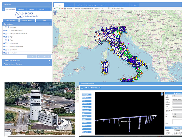
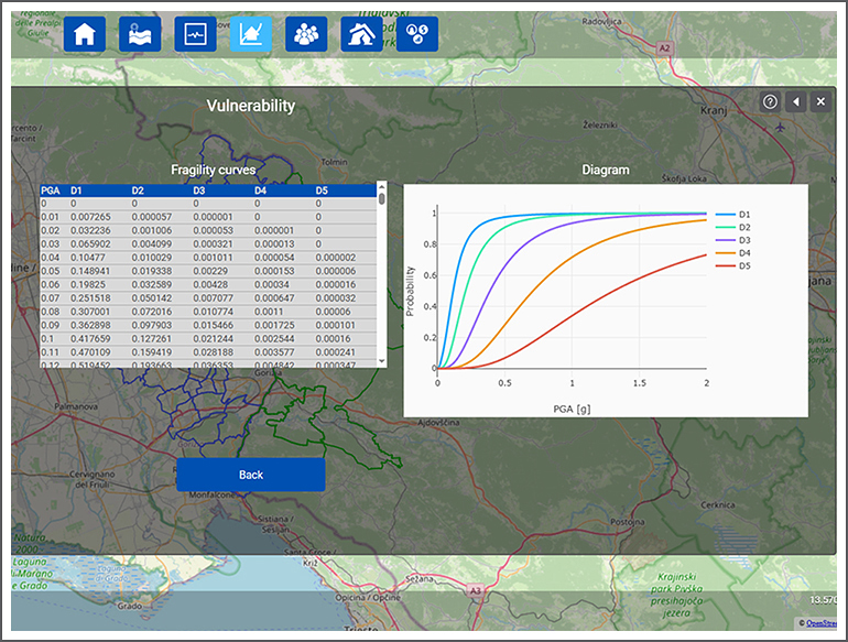
In the field of seismicity in particular, many years of experience have led to the development of seismic micro-zones using probabilistic and deterministic approaches, the production of hazard maps related to ground shaking and co-seismic effects (such as liquefaction and slope instability), and the assessment of the vulnerability of buildings and infrastructure at different spatial scales.
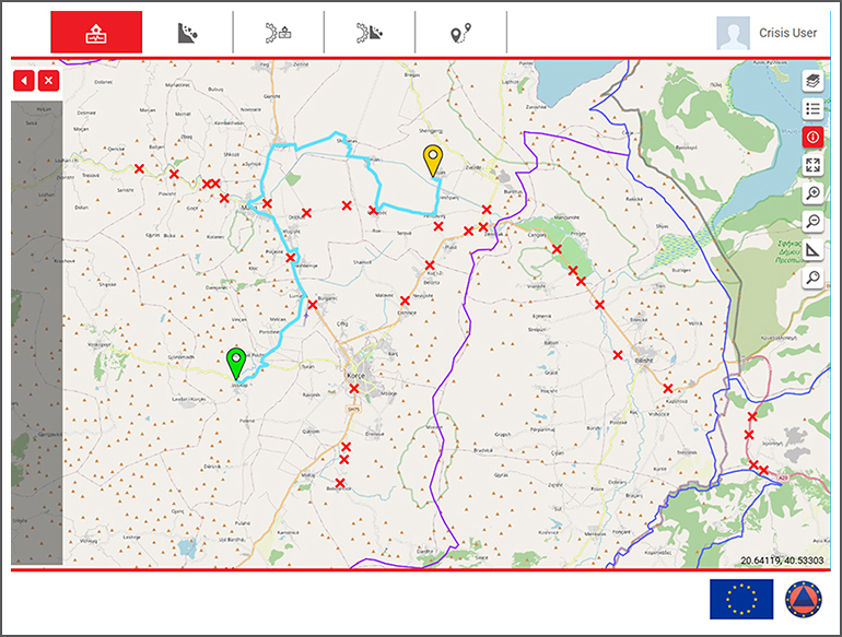
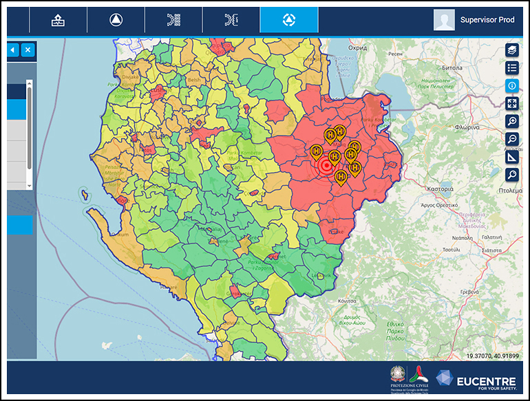
As well as estimating expected damage in the event of an earthquake, the activity includes analysing cascading effects and defining measures to mitigate them. These activities are supported by a computer laboratory dedicated to developing platforms, primarily web-based, equipped with a GIS interface for visualising and managing spatially distributed data. These platforms are particularly useful in the emergency preparation and management phase.